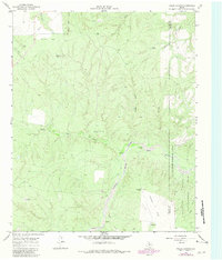
1966 Map of Fields Canyon
USGS Topo · Published 1981About this map
The Middle Pease River meanders through this portion of the Texas Panhandle, carving a complex network of drainages including Fields Canyon and Bar Canyon. The landscape is defined by the transition between high grazing flats like Leary Flat and Baines Flat and the river valley below. Much of the eastern portion of the sheet is dedicated to the Matador Wildlife Management Area, showing the land's conservation status as of the early 1980s. Scattered throughout the cattle country are critical water points for ranching operations, identified by distinct names such as the Richland Windmill, Lucky Knob Windmill, and New Corral Windmill. These landmarks, along with intermittent water features like Bitter Lake Creek and Turtle Hole Creek, illustrate the essential infrastructure required for survival and industry in this arid environment.
Find a feature on this map
23 named features on this map. Tap any name to fly to it.
Don’t see what you’re looking for? This feature index may not catch every label — zoom into the map to look around manually.
Map Details
Editions of this 1966 Fields Canyon Map
2 editions found
Other maps of this area

1954 · Plainview
USGS Topo · 1:250,000

1958 · Plainview
USGS Topo · 1:250,000

1966 · Fields Canyon
USGS Topo · 1:24,000

1966 · Ballard Camp
USGS Topo · 1:24,000

1966 · Cee Vee
USGS Topo · 1:24,000

1966 · Tee Pee City
USGS Topo · 1:24,000

1966 · Devils Canyon
USGS Topo · 1:24,000

1967 · Tell South
USGS Topo · 1:24,000

1967 · Cottonwood Camp
USGS Topo · 1:24,000

1967 · Turtle Hole Camp
USGS Topo · 1:24,000