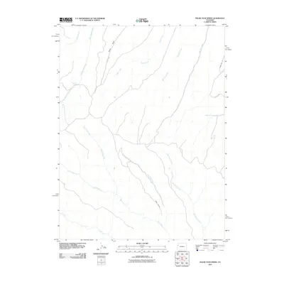
2010 Map of Figure Four Spring
USGS Topo · Published 2010About this map
Figure Four Spring and the high-elevation drainage basins of Garfield County characterize this 2010 U.S. Geological Survey representation of the Western Slope. The landscape is defined by a complex network of seasonal and perennial waterways, including the headwaters of Black Sulphur Creek, Eureka Creek, and the diverging forks of East Willow Creek and West Willow Creek. This hydrological pattern illustrates the vital role of these watersheds in the high-desert and mountain transition zones. Settlement is minimal, represented primarily by the winding routes of County Rd 85 and County Rd 89, which provide access through the steep terrain marked by features like Yankee Gulch and Red Point. The presence of numerous named minor drainages, such as No Name Creek and Mud Springs Creek, underscores the detailed topographical mapping required for water management and navigation in this rural section of Colorado.
Find a feature on this map
18 named features on this map. Tap any name to fly to it.
Don’t see what you’re looking for? This feature index may not catch every label — zoom into the map to look around manually.
Map Details
Editions of this 2010 Figure Four Spring Map
This is the sole edition of this map. No revisions or reprints were ever made.
Other maps of this area

1929 · Highmore
USGS Topo · 1:62,500

1952 · Yankee Gulch
USGS Topo · 1:24,000

1952 · Rock School
USGS Topo · 1:24,000

1956 · Grand Junction
USGS Topo · 1:250,000

1959 · Grand Junction
USGS Topo · 1:250,000

1960 · Grand Junction
USGS Topo · 1:250,000

1962 · Grand Junction
USGS Topo · 1:250,000

1964 · Grand Junction
USGS Topo · 1:250,000

1964 · Henderson Ridge
USGS Topo · 1:24,000

1964 · Black Cabin Gulch
USGS Topo · 1:24,000