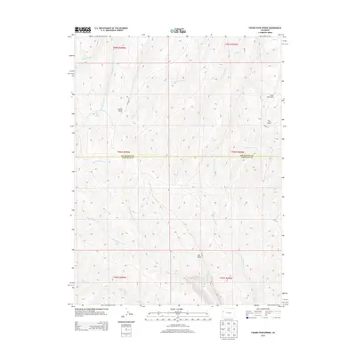
2013 Map of Figure Four Spring
USGS Topo · Published 2013About this map
Figure Four Spring serves as a central landmark in this high-elevation landscape along the border of Rio Blanco and Garfield counties. The terrain is defined by a dense network of drainages and named gulches, including Yankee Gulch and Little Dry Gulch, which carve through the plateau. Water remains the primary geographical marker here, with numerous seasonal and perennial flows such as Black Sulphur Creek, Eureka Creek, and Mud Springs Creek radiating from the ridges. Remote access to this area is maintained through local routes like Co Road 85 and Co Road 69, which follow the natural contours of the land. The prominent lookout at Red Point provides a significant reference for the local topography, overlooking the confluence of various willow and fawn-named creek branches that characterize this part of the Colorado wilderness.
Find a feature on this map
26 named features on this map. Tap any name to fly to it.
Don’t see what you’re looking for? This feature index may not catch every label — zoom into the map to look around manually.
Map Details
Editions of this 2013 Figure Four Spring Map
This is the sole edition of this map. No revisions or reprints were ever made.
Other maps of this area

1929 · Highmore
USGS Topo · 1:62,500

1952 · Yankee Gulch
USGS Topo · 1:24,000

1952 · Rock School
USGS Topo · 1:24,000

1956 · Grand Junction
USGS Topo · 1:250,000

1959 · Grand Junction
USGS Topo · 1:250,000

1960 · Grand Junction
USGS Topo · 1:250,000

1962 · Grand Junction
USGS Topo · 1:250,000

1964 · Grand Junction
USGS Topo · 1:250,000

1964 · Henderson Ridge
USGS Topo · 1:24,000

1964 · Black Cabin Gulch
USGS Topo · 1:24,000