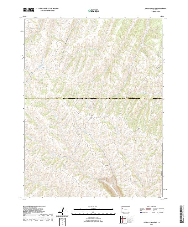
2022 Map of Figure Four Spring
USGS Topo · Published 2022About this map
The boundary between Rio Blanco and Garfield Counties runs through this dissected upland, where high ridges separate a dense network of creek drainages. Dominating the northern landscape, Skinner Ridge and the prominent Red Point provide significant vertical relief above the winding canyons of Eureka Cr and Yankee Gulch. The eponymous Figure Four Spring is located near Black Sulphur Cr, serving as a critical water source in this semi-arid terrain. The map detail highlights the historical importance of localized water access, with features like Mud Springs Cr and Clear Cr carving paths through the high-elevation plateaus. Human presence is sparse, limited to secondary routes like Co RD 69 and unnamed trails that follow the natural contours of the various gulches and ridges.
Find a feature on this map
25 named features on this map. Tap any name to fly to it.
Don’t see what you’re looking for? This feature index may not catch every label — zoom into the map to look around manually.
Map Details
Editions of this 2022 Figure Four Spring Map
This is the sole edition of this map. No revisions or reprints were ever made.
Other maps of this area

1929 · Highmore
USGS Topo · 1:62,500

1952 · Yankee Gulch
USGS Topo · 1:24,000

1952 · Rock School
USGS Topo · 1:24,000

1956 · Grand Junction
USGS Topo · 1:250,000

1959 · Grand Junction
USGS Topo · 1:250,000

1960 · Grand Junction
USGS Topo · 1:250,000

1962 · Grand Junction
USGS Topo · 1:250,000

1964 · Grand Junction
USGS Topo · 1:250,000

1964 · Henderson Ridge
USGS Topo · 1:24,000

1964 · Black Cabin Gulch
USGS Topo · 1:24,000