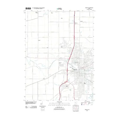
2010 Map of Findlay
USGS Topo · Published 2010About this map
The Blanchard River defines the geography of this Hancock County region, as seen during a period of modern expansion at the turn of the millennium. The city of Findlay serves as the central hub, showing the established grid of the urban core alongside newer peripheral developments like West Park and the University of Findlay. Transportation infrastructure is a prominent theme, from the interstate corridor to smaller aviation facilities such as Priebe Airport and Tathams Stolport, reflecting the area's role as a logistical crossroads.
Find a feature on this map
70 named features on this map. Tap any name to fly to it.
Don’t see what you’re looking for? This feature index may not catch every label — zoom into the map to look around manually.
Map Details
Editions of this 2010 Findlay Map
This is the sole edition of this map. No revisions or reprints were ever made.
Other maps of this area

1903 · Findlay
USGS Topo · 1:62,500

1905 · Arlington
USGS Topo · 1:62,500

1907 · Bluffton
USGS Topo · 1:62,500

1907 · Arlington
USGS Topo · 1:24,000

1950 · Marion
USGS Topo · 1:250,000

1956 · Toledo
USGS Topo · 1:250,000

1960 · Rawson
USGS Topo · 1:24,000

1960 · Bloomdale
USGS Topo · 1:24,000

1960 · North Baltimore
USGS Topo · 1:24,000

1960 · Arlington
USGS Topo · 1:24,000