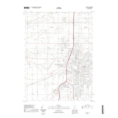
2019 Map of Findlay
USGS Topo · Published 2019About this map
The Blanchard River defines the landscape of Findlay, winding through the city's grid and agricultural surrounds. This modern survey captures the city's role as a regional hub, featuring the Hancock County Courthouse at its center and academic landmarks such as the University of Findlay and Winebrenner Theological Seminary. To the west, the smaller community of Chase sits amidst a network of township and county roads, illustrating the transition from urban density to Ohio’s farmland.
Find a feature on this map
107 named features on this map. Tap any name to fly to it.
Don’t see what you’re looking for? This feature index may not catch every label — zoom into the map to look around manually.
Map Details
Editions of this 2019 Findlay Map
This is the sole edition of this map. No revisions or reprints were ever made.
Other maps of this area

1903 · Findlay
USGS Topo · 1:62,500

1905 · Arlington
USGS Topo · 1:62,500

1907 · Bluffton
USGS Topo · 1:62,500

1907 · Arlington
USGS Topo · 1:24,000

1950 · Marion
USGS Topo · 1:250,000

1956 · Toledo
USGS Topo · 1:250,000

1960 · Rawson
USGS Topo · 1:24,000

1960 · Bloomdale
USGS Topo · 1:24,000

1960 · North Baltimore
USGS Topo · 1:24,000

1960 · Arlington
USGS Topo · 1:24,000