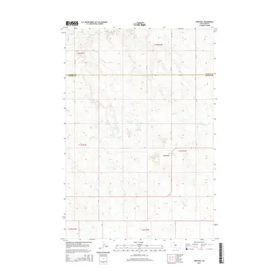
2015 Map of Firesteel
USGS Topo · Published 2015About this map
Firesteel sits as the central settlement on this High Plains landscape, situated just north of the Little Moreau River. The geography is defined by a sparse but vital water network, including the waters of Lake Walton and the winding course of Firesteel Cr in the northern reaches. This 2015 survey illustrates a rural grid system where the Corson Co Dewey Co boundary line bisects the territory, separating the townships of t18n r22e and t17n r22e. The road network, consisting of routes like 132nd St and 241st Ave, reflects the organized land partitioning typical of the region's agricultural and ranching history. The map provides a clear record of the area's physical layout, showing how the drainage of the Little Moreau River shapes the local topography.
Find a feature on this map
24 named features on this map. Tap any name to fly to it.
Don’t see what you’re looking for? This feature index may not catch every label — zoom into the map to look around manually.
Map Details
Editions of this 2015 Firesteel Map
This is the sole edition of this map. No revisions or reprints were ever made.
Other maps of this area

1953 · McIntosh
USGS Topo · 1:250,000

1956 · Miscol SW
USGS Topo · 1:24,000

1956 · Black Horse SW
USGS Topo · 1:24,000

1956 · Black Horse SE
USGS Topo · 1:24,000

1958 · McIntosh
USGS Topo · 1:250,000

1978 · Brewer Butte
USGS Topo · 1:24,000

1978 · Isabel SW
USGS Topo · 1:24,000

1978 · Peach Lake
USGS Topo · 1:24,000

1978 · Isabel
USGS Topo · 1:24,000

1978 · Livermant Lake
USGS Topo · 1:24,000