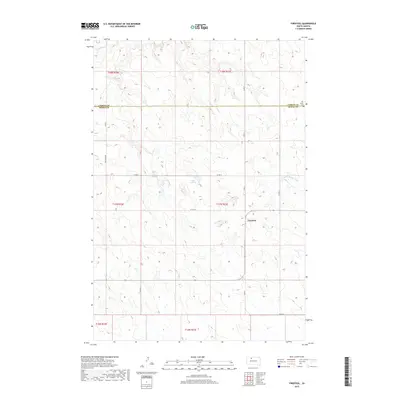
2017 Map of Firesteel
USGS Topo · Published 2017About this map
Firesteel sits at the heart of this South Dakota landscape, marking a modest settlement in a region defined by its wide, drainage-carved prairies. The landscape is bisected by the border between Corson and Dewey counties, a line that runs just south of the Our Savior Cem. Water follows the natural contours of the land, flowing through Firesteel Cr and the Little Moreau River, while Lake Walton provides a distinct landmark in the central terrain. The road network, including the specifically named Coal Mine Rd, suggests the area's historical ties to local industry and resource extraction, connecting these isolated prairie outposts.
Find a feature on this map
14 named features on this map. Tap any name to fly to it.
Don’t see what you’re looking for? This feature index may not catch every label — zoom into the map to look around manually.
Map Details
Editions of this 2017 Firesteel Map
This is the sole edition of this map. No revisions or reprints were ever made.
Other maps of this area

1953 · McIntosh
USGS Topo · 1:250,000

1956 · Miscol SW
USGS Topo · 1:24,000

1956 · Black Horse SW
USGS Topo · 1:24,000

1956 · Black Horse SE
USGS Topo · 1:24,000

1958 · McIntosh
USGS Topo · 1:250,000

1978 · Brewer Butte
USGS Topo · 1:24,000

1978 · Isabel SW
USGS Topo · 1:24,000

1978 · Peach Lake
USGS Topo · 1:24,000

1978 · Isabel
USGS Topo · 1:24,000

1978 · Livermant Lake
USGS Topo · 1:24,000