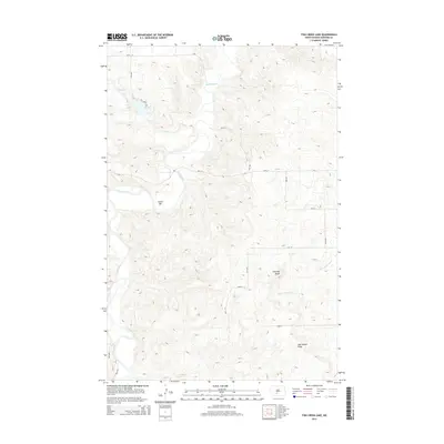
2014 Map of Fish Creek Lake
USGS Topo · Published 2014About this map
The confluence of the Heart River and Little Heart River defines this portion of Morton County, where the high plains break into a network of coulees and buttes. The most prominent water feature is Fish Cr Lake, a reservoir formed along Fish Cr in the northwestern section of the area. This landscape transition is marked by notable elevations such as Chimney Butte and the elongated Oak Coulee Ridge, which overlook the winding river valleys. A structured grid of section roads, including 46th St and 37th Ave, provides access to these uplands, while the Fish Creek Trl offers a more localized path near the water. The presence of Goose Bar along a sharp bend in the river suggests the shifting alluvial character of the waterway, which remains a primary geographical anchor in this part of North Dakota.
Find a feature on this map
22 named features on this map. Tap any name to fly to it.
Don’t see what you’re looking for? This feature index may not catch every label — zoom into the map to look around manually.
Map Details
Editions of this 2014 Fish Creek Lake Map
This is the sole edition of this map. No revisions or reprints were ever made.
Other maps of this area

1954 · Bismarck
USGS Topo · 1:250,000

1958 · Bismarck
USGS Topo · 1:250,000

1970 · Judson
USGS Topo · 1:24,000

1972 · Sweet Briar
USGS Topo · 1:24,000

1972 · Crown Butte Lake
USGS Topo · 1:24,000

1980 · Green Ridge
USGS Topo · 1:24,000

1980 · Otter Creek East
USGS Topo · 1:24,000

1980 · Fallon NE
USGS Topo · 1:24,000
1980 · Fish Creek Lake
USGS Topo · 1:24,000

1980 · Nygren Dam
USGS Topo · 1:24,000