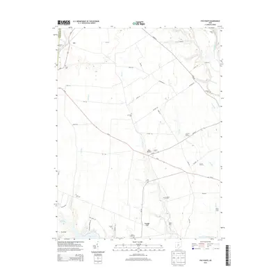
2013 Map of Five Points
USGS Topo · Published 2013About this map
The unincorporated community of Five Points serves as the central hub of this agricultural landscape in Pickaway County, where state routes OH-56 and OH-316 converge. The region is defined by a dense network of family-held land and historical burial grounds, reflecting generations of local heritage. Numerous farm-based cemeteries, such as the Lewis Farm Cem and Curt Knisley Farm Cem, are preserved alongside larger community sites like Greenland Cem and Shilo Cem.
Find a feature on this map
60 named features on this map. Tap any name to fly to it.
Don’t see what you’re looking for? This feature index may not catch every label — zoom into the map to look around manually.
Map Details
Editions of this 2013 Five Points Map
This is the sole edition of this map. No revisions or reprints were ever made.
Other maps of this area

1906 · Mt Sterling
USGS Topo · 1:62,500

1907 · London
USGS Topo · 1:62,500

1911 · Era
USGS Topo · 1:62,500

1913 · Era
USGS Topo · 1:62,500

1923 · West Columbus
USGS Topo · 1:62,500

1925 · West Columbus
USGS Topo · 1:62,500

1943 · Era
USGS Topo · 1:62,500

1947 · Columbus
USGS Topo · 1:250,000

1955 · Harrisburg
USGS Topo · 1:24,000
1955 · Commercial Point
USGS Topo · 1:24,000