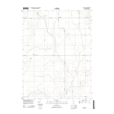
2015 Map of Flatville
USGS Topo · Published 2015About this map
Agricultural patterns and sophisticated water management define this section of Champaign County, where the Spoon River and Salt Fork are supplemented by a complex network of engineered waterways. The presence of the Upper Salt Fork Drainage Ditch, Flatville Drainage Ditch, and Stanton Special Drainage Ditch illustrates the historical effort to reclaim and maintain the fertile prairie soil for high-yield farming. The small settlement of Flatville sits near the northern boundary, while Sellers and the lone rise of Blue Mound characterize the western landscape. Genealogists can locate legacy sites such as Huls Cem and Kopman Cem, which remain as quiet markers of the early families who established these rural communities. The map also captures modern land use, from the private Rash Airport to the gridded county road system that facilitates transport across the flat Illinois interior.
Find a feature on this map
33 named features on this map. Tap any name to fly to it.
Don’t see what you’re looking for? This feature index may not catch every label — zoom into the map to look around manually.
Map Details
Editions of this 2015 Flatville Map
This is the sole edition of this map. No revisions or reprints were ever made.
Other maps of this area

1906 · Urbana
USGS Topo · 1:62,500

1924 · Paxton
USGS Topo · 1:62,500

1927 · Paxton
USGS Topo · 1:62,500

1931 · Fithian
USGS Topo · 1:48,000

1936 · Potomac
USGS Topo · 1:62,500

1943 · Fithian
USGS Topo · 1:62,500

1949 · Paxton
USGS Topo · 1:62,500

1953 · Danville
USGS Topo · 1:250,000

1955 · Danville
USGS Topo · 1:250,000

1956 · Danville
USGS Topo · 1:250,000