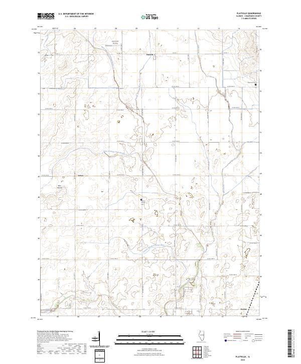
2024 Map of Flatville
USGS Topo · Published 2024About this map
Flatville and the surrounding prairie of Champaign County are defined by a sophisticated network of water management systems designed to support this productive agricultural landscape. The township is crisscrossed by engineered waterways such as the Stanton Special Drainage Ditch, Union Drainage Ditch-Number 1, and the Upper Salt Fork Drainage Ditch, which redirect flow into the natural courses of the Spoon River and the Salt Fork. These drainage patterns are central to the region's identity, allowing for the dense grid of county roads that service local settlements and family sites.
Find a feature on this map
37 named features on this map. Tap any name to fly to it.
Don’t see what you’re looking for? This feature index may not catch every label — zoom into the map to look around manually.
Map Details
Editions of this 2024 Flatville Map
This is the sole edition of this map. No revisions or reprints were ever made.
Other maps of this area

1906 · Urbana
USGS Topo · 1:62,500

1924 · Paxton
USGS Topo · 1:62,500

1927 · Paxton
USGS Topo · 1:62,500

1931 · Fithian
USGS Topo · 1:48,000

1936 · Potomac
USGS Topo · 1:62,500

1943 · Fithian
USGS Topo · 1:62,500

1949 · Paxton
USGS Topo · 1:62,500

1953 · Danville
USGS Topo · 1:250,000

1955 · Danville
USGS Topo · 1:250,000

1956 · Danville
USGS Topo · 1:250,000