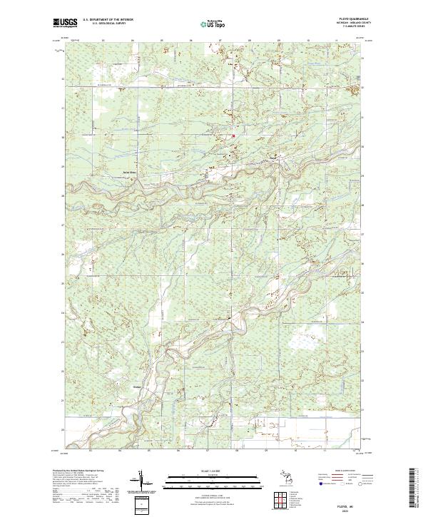
2023 Map of Floyd
USGS Topo · Published 2023About this map
The Chippewa River and Pine River systems converge in this part of Midland County, defining a landscape shaped by glacial heritage and contemporary water management. In the north, the settlement of Floyd sits near Lee Township Cem, while the Chippewa River meanders eastward, joined by a complex network of tributaries including Little Salt Creek and Salt Creek. The terrain is punctuated by Outback Ridge, a distinct elevation change overlooking the river valleys.
Find a feature on this map
62 named features on this map. Tap any name to fly to it.
Don’t see what you’re looking for? This feature index may not catch every label — zoom into the map to look around manually.
Map Details
Editions of this 2023 Floyd Map
This is the sole edition of this map. No revisions or reprints were ever made.
Other maps of this area

1930 · Shepherd
USGS Topo · 1:48,000

1934 · Sanford
USGS Topo · 1:62,500

1934 · Merrill
USGS Topo · 1:62,500

1935 · Alma
USGS Topo · 1:62,500

1936 · Shepherd
USGS Topo · 1:62,500

1936 · Sanford
USGS Topo · 1:62,500

1937 · Merrill
USGS Topo · 1:62,500

1938 · Alma
USGS Topo · 1:62,500

1954 · Midland
USGS Topo · 1:250,000

1958 · Midland
USGS Topo · 1:250,000