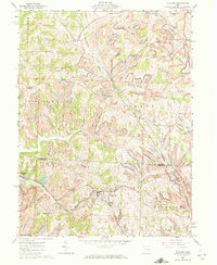
1961 Map of Flushing
USGS Topo · Published 1972About this map
Flushing stands as a central hilltop hub in this 1960s survey of eastern Ohio, where the local economy and geography are defined by the Baltimore and Ohio railroad and extensive coal extraction. The landscape across Harrison Co Belmont Co is marked by numerous Strip Mines, reflecting the industrial character of the era. Settlement patterns follow the winding ridgelines and stream valleys, with small communities like Cassville and New Athens connected by a network of rural roads that navigate the complex drainage systems of Brushy Fork and Jockey Hollow Run.
Find a feature on this map
26 named features on this map. Tap any name to fly to it.
Don’t see what you’re looking for? This feature index may not catch every label — zoom into the map to look around manually.
Map Details
Editions of this 1961 Flushing Map
3 editions found
Other maps of this area

1901 · Cadiz
USGS Topo · 1:62,500

1902 · Scio
USGS Topo · 1:62,500

1903 · Cadiz
USGS Topo · 1:62,500

1903 · Flushing
USGS Topo · 1:62,500

1904 · Scio
USGS Topo · 1:62,500

1905 · St. Clairsville
USGS Topo · 1:62,500

1905 · Flushing
USGS Topo · 1:62,500

1951 · Canton
USGS Topo · 1:250,000

1953 · Canton
USGS Topo · 1:250,000

1957 · Canton
USGS Topo · 1:250,000