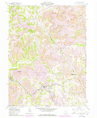
1961 Map of Flushing
USGS Topo · Published 1978About this map
The Baltimore and Ohio railroad corridor anchors this landscape at the intersection of Belmont and Harrison Counties, serving the industrial heart of Eastern Ohio. Extensive Strip Mines dominate the topography between the villages of Holloway and Flushing, reflecting an era of intensive resource extraction that reshaped the hills and valleys. These mining operations are interspersed with remnants of earlier settlement patterns, such as Rankin Ch and Nottingham Ch, which stand as landmarks of rural community life before the expansion of large-scale industrial works.
Find a feature on this map
28 named features on this map. Tap any name to fly to it.
Don’t see what you’re looking for? This feature index may not catch every label — zoom into the map to look around manually.
Map Details
Editions of this 1961 Flushing Map
3 editions found
Other maps of this area

1901 · Cadiz
USGS Topo · 1:62,500

1902 · Scio
USGS Topo · 1:62,500

1903 · Cadiz
USGS Topo · 1:62,500

1903 · Flushing
USGS Topo · 1:62,500

1904 · Scio
USGS Topo · 1:62,500

1905 · St. Clairsville
USGS Topo · 1:62,500

1905 · Flushing
USGS Topo · 1:62,500

1951 · Canton
USGS Topo · 1:250,000

1953 · Canton
USGS Topo · 1:250,000

1957 · Canton
USGS Topo · 1:250,000