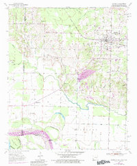
1951 Map of Foreman
USGS Topo · Published 1983About this map
Foreman (New Rocky Comfort) serves as the regional hub in this 1950s era survey, where the St Louis San Francisco railroad cuts through the northeastern corner near a local Gravel Pit. The map captures a complex tri-state border region where Arkansas, Oklahoma, and Texas meet, defined by the winding course of the Red River and its secondary channels like Walnut Bayou. This river-driven landscape is dotted with small rural centers and industrial markers, including Matteson Gin and a prominent Pipeline crossing the terrain.
Find a feature on this map
40 named features on this map. Tap any name to fly to it.
Don’t see what you’re looking for? This feature index may not catch every label — zoom into the map to look around manually.
Map Details
Editions of this 1951 Foreman Map
5 editions found

Other maps of this area

1950 · Redbank
USGS Topo · 1:24,000

1950 · Tom
USGS Topo · 1:24,000

1950 · De Kalb
USGS Topo · 1:24,000

1950 · Winthrop
USGS Topo · 1:24,000

1950 · Bokhoma
USGS Topo · 1:24,000

1951 · De Kalb
USGS Topo · 1:24,000

1951 · Winthrop
USGS Topo · 1:24,000

1951 · Tom
USGS Topo · 1:24,000

1951 · Bokhoma
USGS Topo · 1:24,000

1951 · Redbank
USGS Topo · 1:24,000