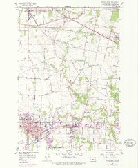
1956 Map of Forest Grove
USGS Topo · Published 1978About this map
Pacific University and the expanding grid of Forest Grove anchor this mid-century look at the Tualatin Valley. The landscape reveals a transition from traditional agricultural clusters like Verboort and Banks toward suburban intensification, evidenced by purple revision tints around Cornelius and Forest Grove. The Southern Pacific RR and Burlington Northern Highway provide the primary transit corridors, while older rail-oriented hamlets like Wilkesboro and Schefflin remain distinct markers in the rural-urban interface.
Find a feature on this map
51 named features on this map. Tap any name to fly to it.
Don’t see what you’re looking for? This feature index may not catch every label — zoom into the map to look around manually.
Map Details
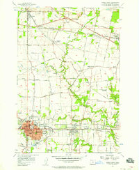
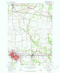
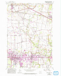
Editions of this 1956 Forest Grove Map
4 editions found
Other maps of this area

1915 · Hillsboro
USGS Topo · 1:62,500

1916 · Tualatin
USGS Topo · 1:62,500

1918 · Hillsboro
USGS Topo · 1:62,500

1939 · Tualatin
USGS Topo · 1:62,500

1940 · Tualatin
USGS Topo · 1:62,500

1940 · Hillsboro
USGS Topo · 1:62,500

1941 · Gales Creek
USGS Topo · 1:62,500

1941 · Yamhill
USGS Topo · 1:62,500

1942 · Yamhill
USGS Topo · 1:62,500

1948 · Vancouver
USGS Topo · 1:250,000