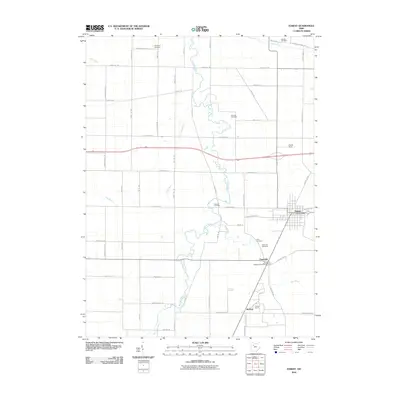
2010 Map of Forest
USGS Topo · Published 2010About this map
The Blanchard River and its various tributaries, including Ripley Run and The Outlet, carve a meandering path through this pocket of Hardin County at the start of the 21st century. The village of Forest serves as the primary population center, anchored by the Forest Post Office along Sandusky St. Further south, the settlement of Patterson is situated near the riverbanks, home to its own Patterson Post Office and several family burial grounds, such as Patterson Cemetery and Price Cemetery.
Find a feature on this map
54 named features on this map. Tap any name to fly to it.
Don’t see what you’re looking for? This feature index may not catch every label — zoom into the map to look around manually.
Map Details
Editions of this 2010 Forest Map
This is the sole edition of this map. No revisions or reprints were ever made.
Other maps of this area

1905 · Arlington
USGS Topo · 1:62,500

1907 · Arlington
USGS Topo · 1:24,000

1907 · Upper Sandusky
USGS Topo · 1:62,500

1915 · Kenton
USGS Topo · 1:62,500

1915 · La Rue
USGS Topo · 1:62,500

1944 · Kenton
USGS Topo · 1:62,500

1950 · Marion
USGS Topo · 1:250,000

1960 · Arlington
USGS Topo · 1:24,000

1960 · Mt Blanchard
USGS Topo · 1:24,000

1960 · Marseilles
USGS Topo · 1:24,000