
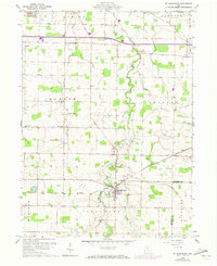
1960 Map of Mt Blanchard
USGS Topo · Published 1962About this map
Blanchard River carves a winding path through the center of this landscape, anchoring the village of Mt Blanchard and the surrounding agricultural townships. The 1960 survey reveals a countryside shaped by drainage and resource extraction, with deep-cut waterlines like Brights Ditch and Aqueduct Ditch alongside a Strip Mine and active Oil Wells near Houcktown. For genealogists and local historians, the sheet is particularly dense with pioneer burial grounds including Frontiers Repose Cem, Siddall Cem, and Castor Cem. The intersection of river and road is further defined by rural religious centers like Salem Ch and Eagle Creek Ch, which served the scattered farmsteads across Jackson and Amanda townships before modern development further altered the terrain.
Find a feature on this map
34 named features on this map. Tap any name to fly to it.
Don’t see what you’re looking for? This feature index may not catch every label — zoom into the map to look around manually.
Map Details
Editions of this 1960 Mt Blanchard Map
Other maps of this area

1901 · Fostoria
USGS Topo · 1:62,500

1903 · Fostoria
USGS Topo · 1:62,500

1903 · Findlay
USGS Topo · 1:62,500

1905 · Arlington
USGS Topo · 1:62,500

1907 · Arlington
USGS Topo · 1:24,000

1907 · Upper Sandusky
USGS Topo · 1:62,500

1950 · Marion
USGS Topo · 1:250,000

1956 · Toledo
USGS Topo · 1:250,000

1960 · Alvada
USGS Topo · 1:24,000

1960 · Arlington
USGS Topo · 1:24,000