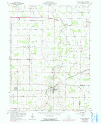
1960 Map of Mt Blanchard
USGS Topo · Published 1990About this map
Mt Blanchard serves as the focal point of this Ohio landscape, where the Blanchard River and Potato Run converge amidst a dense network of township sections. This 1960 survey, later updated with photorevisions, reveals a rural economy shaped by natural resource extraction and small-town aviation, evidenced by several Oil Wells, a Strip Mine, and a local Landing Strip. The map is particularly valuable for genealogical research, documenting numerous burial sites across the townships of Jackson, Amanda, and Delaware, including Frontiers Repose Cem and Riverview Cem.
Find a feature on this map
33 named features on this map. Tap any name to fly to it.
Don’t see what you’re looking for? This feature index may not catch every label — zoom into the map to look around manually.
Map Details
Editions of this 1960 Mt Blanchard Map

Other maps of this area

1901 · Fostoria
USGS Topo · 1:62,500

1903 · Fostoria
USGS Topo · 1:62,500

1903 · Findlay
USGS Topo · 1:62,500

1905 · Arlington
USGS Topo · 1:62,500

1907 · Arlington
USGS Topo · 1:24,000

1907 · Upper Sandusky
USGS Topo · 1:62,500

1950 · Marion
USGS Topo · 1:250,000

1956 · Toledo
USGS Topo · 1:250,000

1960 · Alvada
USGS Topo · 1:24,000

1960 · Arlington
USGS Topo · 1:24,000