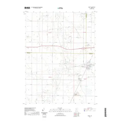
2019 Map of Forest
USGS Topo · Published 2019About this map
The Blanchard River and its various tributaries, including Buck Run and The Outlet, dominate the topography of this rural landscape where Hancock, Hardin, and Wyandot Counties converge. The village of Forest serves as the primary population center, showing a grid of residential streets such as W Dixon St and Sandusky St centered around its commercial core and local Po. To the south, the smaller settlement of Patterson and the site of McVitty reflect the agricultural and rail-oriented development typical of this region of Ohio. Genealogists will find significant value in the numerous burial sites distributed across the townships, including Earlywine Cem, Adams Cem, and Price Cem. The infrastructure is defined by a dense network of township and county roads, such as Co Rd 2 and Twp Rd 50, which connect these dispersed farmsteads and rural cemeteries.
Find a feature on this map
55 named features on this map. Tap any name to fly to it.
Don’t see what you’re looking for? This feature index may not catch every label — zoom into the map to look around manually.
Map Details
Editions of this 2019 Forest Map
This is the sole edition of this map. No revisions or reprints were ever made.
Other maps of this area

1905 · Arlington
USGS Topo · 1:62,500

1907 · Arlington
USGS Topo · 1:24,000

1907 · Upper Sandusky
USGS Topo · 1:62,500

1915 · Kenton
USGS Topo · 1:62,500

1915 · La Rue
USGS Topo · 1:62,500

1944 · Kenton
USGS Topo · 1:62,500

1950 · Marion
USGS Topo · 1:250,000

1960 · Arlington
USGS Topo · 1:24,000

1960 · Mt Blanchard
USGS Topo · 1:24,000

1960 · Marseilles
USGS Topo · 1:24,000