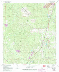
1971 Map of Forest Hill
USGS Topo · Published 1993About this map
Kisatchie National Forest dominates much of this Rapides Parish landscape, which is marked by a complex legacy of timber, transit, and military use. The map captures the area around Forest Hill and Longleaf during a period of transition, showing the intersection of natural resources and 20th-century recreation. Evidence of past industry is visible in the numerous Gravel Pits and an Old Railroad Grade that winds through the terrain.
Find a feature on this map
42 named features on this map. Tap any name to fly to it.
Don’t see what you’re looking for? This feature index may not catch every label — zoom into the map to look around manually.
Map Details
Editions of this 1971 Forest Hill Map
2 editions found
Other maps of this area

1935 · Pawnee
USGS Topo · 1:31,680

1935 · Turkey Creek
USGS Topo · 1:62,500

1935 · Lecompte
USGS Topo · 1:62,500

1942 · Oakdale
USGS Topo · 1:62,500

1949 · Glenmora
USGS Topo · 1:31,680

1949 · Turkey Creek
USGS Topo · 1:62,500

1952 · Lake Charles
USGS Topo · 1:250,000

1953 · Alexandria
USGS Topo · 1:250,000
1954 · Pawnee
USGS Topo · 1:31,680

1954 · Lake Charles
USGS Topo · 1:250,000