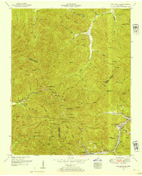
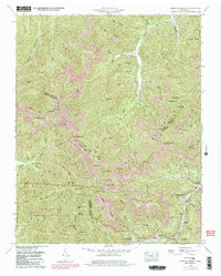
1952 Map of Fork Mountain
USGS Topo · Published 1954About this map
The Emory River and its numerous tributaries carve through the heart of this Cumberland Plateau landscape, defining the early 1950s settlement patterns of the Scott and Morgan County border. Resource extraction is central to the local economy, evidenced by numerous coal labels and infrastructure like the dismantled railroad and dismantled incline near Buffalo. Small communities like Mahan Village, Hembree, and Moores Camp are clustered along the valley floors, while the higher elevations of Bird Mountain and Smoky Mountain remain largely protected within the Morgan State Forest. For genealogists, the map is a dense record of family history, pinpointing several burial grounds including the Reeves-Daugherty Cemetery and Patterson Cemetery, alongside local landmarks such as the Beech Grove Church.
Find a feature on this map
87 named features on this map. Tap any name to fly to it.
Don’t see what you’re looking for? This feature index may not catch every label — zoom into the map to look around manually.
Map Details
Editions of this 1952 Fork Mountain Map
5 editions found
Other maps of this area

1893 · Briceville
USGS Topo · 1:125,000

1895 · Wartburg
USGS Topo · 1:125,000

1895 · Briceville
USGS Topo · 1:125,000

1896 · Wartburg
USGS Topo · 1:125,000

1896 · Briceville
USGS Topo · 1:125,000

1935 · Gobey
USGS Topo · 1:24,000

1935 · Camp Austin
USGS Topo · 1:24,000

1936 · Hogbell Gap
USGS Topo · 1:24,000

1936 · Block
USGS Topo · 1:24,000

1936 · Duncan Flats
USGS Topo · 1:24,000