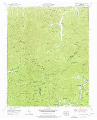
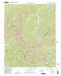
1952 Map of Fork Mountain
USGS Topo · Published 1977About this map
Smoky Mountain and the high ridges of the Cumberland Plateau dominate this 1952 topographic study, where the coal-driven economy of East Tennessee is recorded in detail. Small company towns and residential clusters such as Moores Camp (Devonia PO), Mahan Village, and Hembree are connected by the winding path of Tennessee 116 and numerous coal extraction sites. The map documents an industrial landscape in transition, showing a dismantled railroad and dismantled incline near Buffalo, alongside active resource management in the Morgan State Forest. For genealogists, the presence of family-named landmarks like the Reeves-Daugherty Cemetery and Patterson Cemetery, as well as the Beech Grove Church, provide specific locations for mid-century community life. The rugged drainages of Smoky Creek and the Emory River define the settlement patterns, forcing homes and industry into the narrow valley floors.
Find a feature on this map
122 named features on this map. Tap any name to fly to it.
Don’t see what you’re looking for? This feature index may not catch every label — zoom into the map to look around manually.
Map Details
Editions of this 1952 Fork Mountain Map
5 editions found
Other maps of this area

1893 · Briceville
USGS Topo · 1:125,000

1895 · Wartburg
USGS Topo · 1:125,000

1895 · Briceville
USGS Topo · 1:125,000

1896 · Wartburg
USGS Topo · 1:125,000

1896 · Briceville
USGS Topo · 1:125,000

1935 · Gobey
USGS Topo · 1:24,000

1935 · Camp Austin
USGS Topo · 1:24,000

1936 · Hogbell Gap
USGS Topo · 1:24,000

1936 · Block
USGS Topo · 1:24,000

1936 · Duncan Flats
USGS Topo · 1:24,000