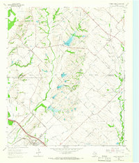
1963 Map of Forney North
USGS Topo · Published 1966About this map
The Rockwall Co Kaufman Co boundary line bisects this landscape, marking a transition from the agricultural uplands toward the sprawling drainage of the East Fork Trinity River. In the mid-1960s, the area's rural character is defined by scattered farmsteads and small settlements like Heath and McLendon, with the growing town of Forney situated along the Texas and Pacific railroad in the south. The land is heavily articulated by a dense network of waterways including Little Buffalo Creek and Mustang Creek, with several sections marked for controlled inundation.
Find a feature on this map
29 named features on this map. Tap any name to fly to it.
Don’t see what you’re looking for? This feature index may not catch every label — zoom into the map to look around manually.
Map Details
Editions of this 1963 Forney North Map
Other maps of this area

1891 · Dallas
USGS Topo · 1:125,000

1893 · Dallas
USGS Topo · 1:125,000

1912 · Rockwall
USGS Topo · 1:31,680

1919 · Royse City
USGS Topo · 1:62,500

1954 · Dallas
USGS Topo · 1:250,000

1956 · Kaufman
USGS Topo · 1:62,500

1958 · Dallas
USGS Topo · 1:250,000

1959 · Mesquite
USGS Topo · 1:24,000

1959 · Seagoville
USGS Topo · 1:24,000
1959 · Rowlett
USGS Topo · 1:24,000