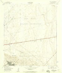
1955 Map of Fort Bliss SE
USGS Topo · Published 1959About this map
Biggs Air Force Base and the expansive Fort Bliss Military Reservation dominate this mid-century landscape on the edge of El Paso. The map illustrates the city's outward expansion toward the desert, with residential developments like Del Norte Heights and Hacienda Heights appearing in the southwest corner. The transition from urban center to military training grounds is marked by utility infrastructure, including a prominent Telephone line and several Pipeline corridors cutting across the arid terrain.
Find a feature on this map
23 named features on this map. Tap any name to fly to it.
Don’t see what you’re looking for? This feature index may not catch every label — zoom into the map to look around manually.
Map Details
Editions of this 1955 Fort Bliss SE Map
3 editions found
Other maps of this area

1896 · El Paso
USGS Topo · 1:125,000

1908 · El Paso
USGS Topo · 1:125,000

1939 · Ysleta
USGS Topo · 1:62,500

1939 · Heuco Tanks
USGS Topo · 1:62,500

1940 · Heuco Tanks
USGS Topo · 1:62,500

1941 · El Paso
USGS Topo · 1:31,680

1941 · Clint
USGS Topo · 1:62,500

1941 · Ysleta
USGS Topo · 1:62,500

1942 · Fort Bliss
USGS Topo · 1:62,500

1943 · El Paso
USGS Topo · 1:31,680
Featured Places
- El Paso, TX
- Turf Estates Number 1 Colonia, TX
- Las Palmas Number 2 Colonia, El Paso
- Las Palmas Colonia, El Paso
- Del Norte Heights, El Paso