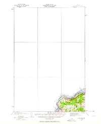
1932 Map of Fort Kent
USGS Topo · Published 1964About this map
The St John River defines the international boundary between the Canada United States border in this northern Aroostook County landscape. Topographer W. S. Higginson documented the confluence of the Fish River and the St John at the town of Fort Kent, which serves as a vital transportation hub for both the Bangor and Aroostook railroad and regional road networks. The settlement pattern is concentrated along these watercourses and rail lines, with rural education centers such as Roosevelt Sch, Hillside Sch, and Daigle Sch distributed to serve the farming and timber communities. Numerous small tributaries including Audibert Brook, Charette Bk, and Redpost Bk drain the surrounding hills into the primary river valley, reflecting the area's dependence on natural drainage for local industry and transport in the early 1930s.
Find a feature on this map
16 named features on this map. Tap any name to fly to it.
Don’t see what you’re looking for? This feature index may not catch every label — zoom into the map to look around manually.
Map Details
Editions of this 1932 Fort Kent Map
4 editions found
Other maps of this area

1927 · Square Lake
USGS Topo · 1:48,000

1928 · Eagle Lake
USGS Topo · 1:48,000

1930 · St Francis
USGS Topo · 1:48,000

1931 · Square Lake
USGS Topo · 1:62,500

1931 · Eagle Lake
USGS Topo · 1:62,500

1932 · Frenchville
USGS Topo · 1:48,000

1932 · Fort Kent
USGS Topo · 1:48,000

1933 · St Francis
USGS Topo · 1:62,500

1935 · Fort Kent
USGS Topo · 1:62,500

1935 · Frenchville
USGS Topo · 1:62,500