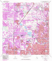
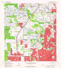
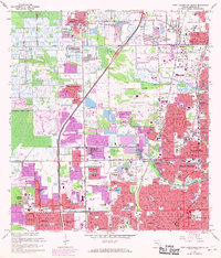
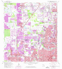
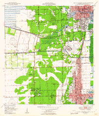
1962 Map of Fort Lauderdale North
USGS Topo · Published 1984About this map
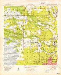
Fort Lauderdale and its northern neighbors undergo a period of rapid suburban expansion in this early 1960s survey, with updates from the 1980s showing the filling in of residential tracts. The landscape is defined by its extensive network of waterways, including the Middle River Canal and the Cypress Creek, which bisect the burgeoning planned communities of Coral Springs, Tamarac, and North Lauderdale. This era captures the transition from open Florida scrub and agricultural land to a dense grid of leisure-oriented developments, as evidenced by the proliferation of golf courses and the Palm Aire Country Club. Local institutional history is anchored by the Florida Military Academy and the Dillard High Sch, while the presence of several large memorial sites like Queen of Heaven Cemetery and Sunset Mem Gardens provides important touchstones for genealogical research in Broward County.
Find a feature on this map
100 named features on this map. Tap any name to fly to it.
Don’t see what you’re looking for? This feature index may not catch every label — zoom into the map to look around manually.
Map Details
Editions of this 1962 Fort Lauderdale North Map
4 editions found
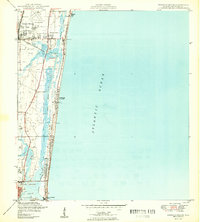
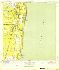
Other maps of this area

1945 · Fort Lauderdale North
USGS Topo · 1:24,000

1946 · West Dixie Bend
USGS Topo · 1:24,000
1946 · Boca Raton
USGS Topo · 1:24,000
1949 · Fort Lauderdale North
USGS Topo · 1:24,000
1949 · West Dixie Bend
USGS Topo · 1:24,000
1949 · Port Everglades
USGS Topo · 1:24,000
1949 · Fort Lauderdale South
USGS Topo · 1:24,000
1949 · Pompano Beach
USGS Topo · 1:24,000
1950 · Boca Raton
USGS Topo · 1:24,000

1956 · West Palm Beach
USGS Topo · 1:250,000