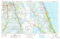
1956 Map of Fort Pierce
USGS Topo · Published 1976About this map
Lake Okeechobee and the Indian River lagoon system anchor this mid-century survey of the Florida peninsula, showing a region defined by its vast water bodies and emerging Cold War infrastructure. The inland landscape is dominated by a chain of freshwater lakes, including the expansive Lake Istokpoga and Lake Kissimmee, alongside the sprawling Avon Park Bombing Range. Along the Atlantic coast, the presence of the Valkaria Missile Tracking Station (USAF) and Fellsmere Missile Tracking Station (USAF) reflects the era's aerospace expansion.
Find a feature on this map
139 named features on this map. Tap any name to fly to it.
Don’t see what you’re looking for? This feature index may not catch every label — zoom into the map to look around manually.
Map Details
Editions of this 1956 Fort Pierce Map
4 editions found

Other maps of this area

1944 · Plant City
USGS Topo · 1:31,680

1944 · Lakeland
USGS Topo · 1:31,680

1944 · Auburndale
USGS Topo · 1:31,680

1948 · Palm City
USGS Topo · 1:24,000

1948 · Ankona
USGS Topo · 1:24,000

1948 · Rood
USGS Topo · 1:24,000

1948 · St. Lucie Inlet
USGS Topo · 1:24,000

1948 · Gomez
USGS Topo · 1:24,000

1948 · Hobe Sound
USGS Topo · 1:24,000

1948 · Jupiter
USGS Topo · 1:24,000