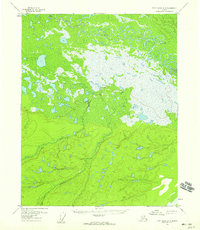
1956 Map of Fort Yukon A-3
USGS Topo · Published 1959About this map
Birch Creek dominates the northern reaches of this landscape, its path defined by an intricate network of abandoned oxbows and meanders that trace the shifting history of the waterway. The transition from the saturated lowlands to the elevated terrain in the south is marked by Discovery Creek, which drains toward the expansive marshy plains above the Arctic Circle. This mid-century survey, based on aerial photography from the early 1950s, reveals a wild and unpopulated wilderness where survival is dictated by the hydrology of the Yukon River basin. The inclusion of survey markers like Vabm 482 and landmarks such as Egil Island provides essential reference points for navigating a region defined by its lack of roads or permanent settlements.
Find a feature on this map
4 named features on this map. Tap any name to fly to it.
Don’t see what you’re looking for? This feature index may not catch every label — zoom into the map to look around manually.
Map Details
Editions of this 1956 Fort Yukon A-3 Map
2 editions found
Other maps of this area

1951 · Fort Yukon
USGS Topo · 1:250,000

1951 · Circle
USGS Topo · 1:250,000

1952 · Circle D-4
USGS Topo · 1:63,360

1952 · Circle D-3
USGS Topo · 1:63,360

1952 · Circle D-2
USGS Topo · 1:63,360

1955 · Circle
USGS Topo · 1:250,000

1956 · Fort Yukon B-4
USGS Topo · 1:63,360

1956 · Fort Yukon A-2
USGS Topo · 1:63,360

1956 · Fort Yukon A-4
USGS Topo · 1:63,360

1956 · Fort Yukon B-3
USGS Topo · 1:63,360