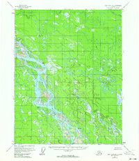
1956 Map of Fort Yukon B-2
USGS Topo · Published 1964About this map
The Yukon River dominates this mid-century landscape, carving a complex network of channels and sloughs through the Alaskan interior. This survey, based on 1952 aerial photography, documents a terrain defined by shifting water and remote outposts. Evidence of seasonal habitation and bush aviation appears in small clusters of Cabins and a designated Cabin (Airstrip) located along the riverbanks.
Find a feature on this map
10 named features on this map. Tap any name to fly to it.
Don’t see what you’re looking for? This feature index may not catch every label — zoom into the map to look around manually.
Map Details
Editions of this 1956 Fort Yukon B-2 Map
2 editions found
Other maps of this area

1951 · Fort Yukon
USGS Topo · 1:250,000

1952 · Fort Yukon C-2
USGS Topo · 1:63,360

1952 · Fort Yukon C-3
USGS Topo · 1:63,360

1955 · Fort Yukon C-3
USGS Topo · 1:63,360

1956 · Fort Yukon C-1
USGS Topo · 1:63,360

1956 · Fort Yukon A-2
USGS Topo · 1:63,360

1956 · Fort Yukon B-3
USGS Topo · 1:63,360

1956 · Fort Yukon B-1
USGS Topo · 1:63,360

1956 · Fort Yukon A-1
USGS Topo · 1:63,360

1956 · Fort Yukon B-2
USGS Topo · 1:63,360