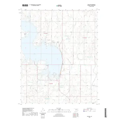
2018 Map of Foss Dam
USGS Topo · Published 2018About this map
Butler stands as the primary settlement in this Custer County landscape, situated on the northeastern shores of the expansive Foss Reservoir. This artificial body of water, formed by the construction of Foss Dam across the Washita River, dominates the central portion of the quadrangle. The surrounding terrain is heavily defined by sophisticated water management systems, including numerous smaller catchments like the Butler Laterals Site 2 Reservoir and the Soldier Cr Watershed Site 10 Reservoir. These features underscore the importance of flood control and agricultural irrigation in western Oklahoma.
Find a feature on this map
78 named features on this map. Tap any name to fly to it.
Don’t see what you’re looking for? This feature index may not catch every label — zoom into the map to look around manually.
Map Details
Editions of this 2018 Foss Dam Map
This is the sole edition of this map. No revisions or reprints were ever made.
Other maps of this area

1955 · Clinton
USGS Topo · 1:250,000

1957 · Clinton
USGS Topo · 1:250,000

1957 · Butler
USGS Topo · 1:62,500

1957 · Dill City
USGS Topo · 1:62,500

1960 · Hammon
USGS Topo · 1:62,500

1961 · Elk City
USGS Topo · 1:62,500

1976 · Butler NW
USGS Topo · 1:24,000

1976 · Butler NE
USGS Topo · 1:24,000

1976 · Butler SW
USGS Topo · 1:24,000

1976 · Dill City NE
USGS Topo · 1:24,000