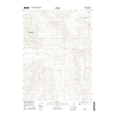
2015 Map of Fossil
USGS Topo · Published 2015About this map
Fossil Butte National Monument dominates the western portion of this Lincoln County landscape, centered around the landmark Fossil Butte and the settlement of Fossil. This high-elevation terrain is defined by its position on the Colorado River Divide Great Basin, where the drainage patterns shift between major continental systems. The map detail highlights a complex network of waterways, including Twin Cr, N Fork Twin Cr, and Clear Cr, which carve through the prominent Fossil Ridge.
Find a feature on this map
23 named features on this map. Tap any name to fly to it.
Don’t see what you’re looking for? This feature index may not catch every label — zoom into the map to look around manually.
Map Details
Editions of this 2015 Fossil Map
This is the sole edition of this map. No revisions or reprints were ever made.
Other maps of this area

1954 · Sage
USGS Topo · 1:62,500

1954 · Ogden
USGS Topo · 1:250,000

1954 · Kemmerer
USGS Topo · 1:62,500

1958 · Ogden
USGS Topo · 1:250,000

1960 · Ogden
USGS Topo · 1:250,000

1962 · Bell Butte NE
USGS Topo · 1:24,000

1962 · Elkol
USGS Topo · 1:24,000

1962 · Warfield Creek
USGS Topo · 1:24,000
1979 · Kemmerer
USGS Topo · 1:100,000
1985 · Sublet
USGS Topo · 1:24,000