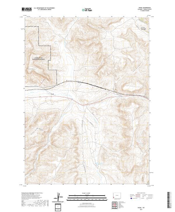
2021 Map of Fossil
USGS Topo · Published 2021About this map
Fossil Butte National Monument anchors the northwestern corner of this Wyoming landscape, preserving a world-renowned paleontological site known for its exceptionally preserved Eocene-era fish. The terrain is dramatically split by the Colorado River Divide Great Basin, a continental hydrologic boundary that separates the waters of the Pacific from the interior drainage. Below the heights of Fossil Butte and Fossil Ridge, the settlement of Fossil sits along the banks of Twin Cr, reflecting the region's long association with both the railroad and early fossil collection. The intricate drainage network of N Fork Twin Cr, S Fork Twin Cr, and E Fork Twin Cr converges here, while the C H Smith Reservoir and the Historic Quarry Trl highlight the human history of land use, from ranching to scientific excavation in the high desert.
Find a feature on this map
26 named features on this map. Tap any name to fly to it.
Don’t see what you’re looking for? This feature index may not catch every label — zoom into the map to look around manually.
Map Details
Editions of this 2021 Fossil Map
This is the sole edition of this map. No revisions or reprints were ever made.
Other maps of this area

1954 · Sage
USGS Topo · 1:62,500

1954 · Ogden
USGS Topo · 1:250,000

1954 · Kemmerer
USGS Topo · 1:62,500

1958 · Ogden
USGS Topo · 1:250,000

1960 · Ogden
USGS Topo · 1:250,000

1962 · Bell Butte NE
USGS Topo · 1:24,000

1962 · Elkol
USGS Topo · 1:24,000

1962 · Warfield Creek
USGS Topo · 1:24,000
1979 · Kemmerer
USGS Topo · 1:100,000
1985 · Sublet
USGS Topo · 1:24,000