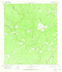
1958 Map of Fostoria
USGS Topo · Published 1973About this map
The dense woodlands of the Sam Houston National Forest dominate this topography at the meeting point of Montgomery, Liberty, and San Jacinto Counties. The landscape is defined by the lumber and rail industry, with the Gulf Colorado and Santa Fe and the Texas and New Orleans (Southern Pacific) railroads cutting through the timberlands. Rural life centers on scattered settlements like Fostoria and Security, where the Security Siding and a Gravel Pit indicate active industrial transport. The area is heavily networked with water, from the winding path of Peach Creek to smaller basins like Ward Pond and Bailey Pond. Local heritage is anchored by country sanctuaries and burial grounds, including Calvary Ch, Pilgrim Rest Ch, and the Morgan Cem, reflecting the small, interconnected communities of the mid-20th century Texas Piney Woods.
Find a feature on this map
37 named features on this map. Tap any name to fly to it.
Don’t see what you’re looking for? This feature index may not catch every label — zoom into the map to look around manually.
Map Details
Editions of this 1958 Fostoria Map
3 editions found
Other maps of this area

1954 · Beaumont
USGS Topo · 1:250,000

1957 · Beaumont
USGS Topo · 1:250,000

1958 · Fostoria
USGS Topo · 1:24,000

1958 · Cleveland
USGS Topo · 1:24,000

1958 · Westcott
USGS Topo · 1:24,000

1958 · Bear Creek
USGS Topo · 1:24,000

1959 · Plum Grove
USGS Topo · 1:24,000

1959 · Outlaw Pond
USGS Topo · 1:24,000

1959 · Cut and Shoot
USGS Topo · 1:24,000

1959 · Conroe NE
USGS Topo · 1:24,000