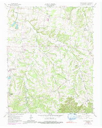
1958 Map of Fountain Head
USGS Topo · Published 1992About this map
Louisville and Nashville tracks through the western hills of Sumner County, anchoring small communities like Fountain Head and Buck Lodge during the mid-20th century. This area is defined by the headwaters of West Fork Drakes Creek and the Caney Fork, where small rural settlements such as Sengtown, Corinth, and Brackentown emerged along the ridges. The landscape is dotted with several country churches and schools, including Mt Moriah Ch and the Highland Academy, reflecting a deeply established agrarian social structure.
Find a feature on this map
38 named features on this map. Tap any name to fly to it.
Don’t see what you’re looking for? This feature index may not catch every label — zoom into the map to look around manually.
Map Details
Editions of this 1958 Fountain Head Map
2 editions found
Other maps of this area

1903 · Nashville
USGS Topo · 1:125,000

1928 · Adolphus
USGS Topo · 1:48,000

1931 · Adolphus
USGS Topo · 1:62,500

1942 · Gallatin
USGS Topo · 1:100,000

1951 · Franklin
USGS Topo · 1:24,000

1953 · Cottontown
USGS Topo · 1:24,000
1954 · Hickory Flat
USGS Topo · 1:24,000

1954 · Adolphus
USGS Topo · 1:24,000

1955 · Bethpage
USGS Topo · 1:24,000

1955 · Gallatin
USGS Topo · 1:24,000