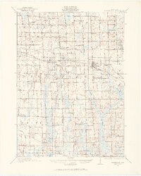
1908 Map of Fowlerville
USGS Topo · Published 1969About this map
The Pere Marquette railroad anchors the landscape of central Michigan in this early twentieth-century survey, linking the growing hubs of Webberville and Fowlerville. This region, split between Ingham and Livingston counties, reveals a dense network of rural schoolhouses spaced almost every two miles, serving the agricultural townships of Locke, Conway, Leroy, and Handy. These small institutions, such as Podunk School, Sixteen School, and Rowley School, reflect the decentralized education system before the era of district consolidation.
Find a feature on this map
81 named features on this map. Tap any name to fly to it.
Don’t see what you’re looking for? This feature index may not catch every label — zoom into the map to look around manually.
Map Details
Editions of this 1908 Fowlerville Map
2 editions found
Other maps of this area

1902 · Dexter
USGS Topo · 1:62,500

1904 · Ann Arbor
USGS Topo · 1:125,000

1906 · Dexter
USGS Topo · 1:62,500

1907 · Howell
USGS Topo · 1:62,500

1908 · Ann Arbor
USGS Topo · 1:125,000

1908 · Fowlerville
USGS Topo · 1:62,500

1909 · Howell
USGS Topo · 1:62,500

1909 · Mason
USGS Topo · 1:62,500

1910 · Fowlerville
USGS Topo · 1:62,500

1911 · Mason
USGS Topo · 1:62,500