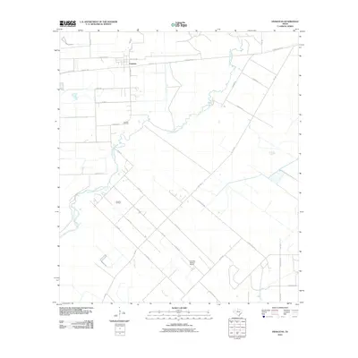
2010 Map of Francitas
USGS Topo · Published 2010About this map
Francitas serves as the primary hub in this coastal prairie landscape of Jackson County, where the settlement pattern is defined by a rigid grid of rural roads intersecting the winding course of East Carancahua Creek. The geography reflects a mix of traditional ranching and petroleum industry influence, most notably evidenced by the Francitas Oil Field south of the town site. For family historians, the Francitas Cemetery is a critical landmark situated near the creek's bend. The map also reveals the aviation footprint of the region at Kubecka Aviation Airport, located amidst a network of family-named thoroughfares like Machalik Rd and Slone Ranch Rd. This 2010 survey documents the modern drainage and road system, including Farm Market 616, as it crosses the riparian corridors of Turtle Creek and Reed Creek.
Find a feature on this map
39 named features on this map. Tap any name to fly to it.
Don’t see what you’re looking for? This feature index may not catch every label — zoom into the map to look around manually.
Map Details
Editions of this 2010 Francitas Map
This is the sole edition of this map. No revisions or reprints were ever made.
Other maps of this area

1952 · Francitas NW
USGS Topo · 1:24,000

1952 · Palacios
USGS Topo · 1:24,000

1952 · Olivia
USGS Topo · 1:24,000

1952 · Turtle Bay
USGS Topo · 1:24,000

1952 · Francitas
USGS Topo · 1:24,000

1952 · Blessing
USGS Topo · 1:24,000

1952 · Francitas NE
USGS Topo · 1:24,000

1952 · Midfield
USGS Topo · 1:24,000

1952 · La Ward
USGS Topo · 1:24,000

1953 · Beeville
USGS Topo · 1:250,000