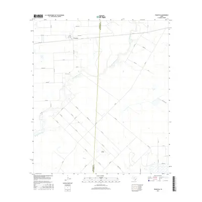
2016 Map of Francitas
USGS Topo · Published 2016About this map
Francitas occupies a grid-iron layout in the northern reaches of this coastal prairie landscape, where the flat terrain is defined by a network of drainage ways and rural farm-to-market roads. The town's proximity to the Jackson and Matagorda county line is clear, with the border cutting vertically through the center of the survey. Significant local genealogy and community markers include Francitas Cem located south of the main townsite and the Kubecka Aviation landing strip situated near the southern edge of the quadrangle. The physical geography is dominated by the meandering course of East Carancahua Creek, which snakes through the central region, eventually joined by smaller tributaries like Reed Cr and Turtle Cr. This landscape reflects a late-twentieth and early-twenty-first-century agricultural pattern, where family-named roads like Bullock Rd and Meinke Rd provide access to dispersed farmsteads across the coastal plains.
Find a feature on this map
52 named features on this map. Tap any name to fly to it.
Don’t see what you’re looking for? This feature index may not catch every label — zoom into the map to look around manually.
Map Details
Editions of this 2016 Francitas Map
This is the sole edition of this map. No revisions or reprints were ever made.
Other maps of this area

1952 · Francitas NW
USGS Topo · 1:24,000

1952 · Palacios
USGS Topo · 1:24,000

1952 · Olivia
USGS Topo · 1:24,000

1952 · Turtle Bay
USGS Topo · 1:24,000

1952 · Francitas
USGS Topo · 1:24,000

1952 · Blessing
USGS Topo · 1:24,000

1952 · Francitas NE
USGS Topo · 1:24,000

1952 · Midfield
USGS Topo · 1:24,000

1952 · La Ward
USGS Topo · 1:24,000

1953 · Beeville
USGS Topo · 1:250,000