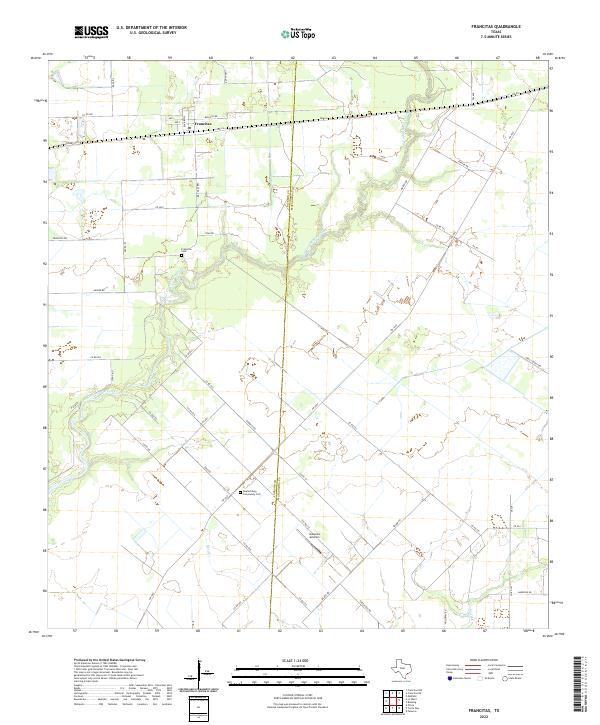
2022 Map of Francitas
USGS Topo · Published 2022About this map
Francitas sits at the northern edge of this coastal prairie landscape, where the survey captures the intersection of rural Texas life and modern agricultural aviation. The terrain is defined by the winding course of East Carancahua Creek, which meanders through the center of the sheet toward the Gulf. A significant portion of the area is partitioned by the boundary between Jackson Co and Matagorda Co, dividing the coastal plain into a grid of ranch and farm roads. Genealogy researchers will find localized detail at the Deutschburg Community Cem near the southern boundary and the Francitas Cem closer to the settlement. The presence of Kubecka Aviation underscores the importance of aerial agriculture in this region, while the drainage systems of Reed Cr and Turtle Cr illustrate the hydrological pattern of the lowland flats.
Find a feature on this map
53 named features on this map. Tap any name to fly to it.
Don’t see what you’re looking for? This feature index may not catch every label — zoom into the map to look around manually.
Map Details
Editions of this 2022 Francitas Map
This is the sole edition of this map. No revisions or reprints were ever made.
Other maps of this area

1952 · Francitas NW
USGS Topo · 1:24,000

1952 · Palacios
USGS Topo · 1:24,000

1952 · Olivia
USGS Topo · 1:24,000

1952 · Turtle Bay
USGS Topo · 1:24,000

1952 · Francitas
USGS Topo · 1:24,000

1952 · Blessing
USGS Topo · 1:24,000

1952 · Francitas NE
USGS Topo · 1:24,000

1952 · Midfield
USGS Topo · 1:24,000

1952 · La Ward
USGS Topo · 1:24,000

1953 · Beeville
USGS Topo · 1:250,000