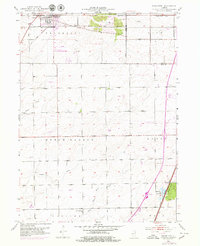
1953 Map of Frankfort
USGS Topo · Published 1979About this map
The town of Frankfort and the neighboring Lincoln Estates are the primary hubs in this mid-century look at the border of Will and Cook counties. The landscape is defined by its early transport routes and watercourses, including the Old Indian Boundary and the Elgin Joliet and Eastern railroad. Significant for genealogists, the map preserves the locations of numerous small burial grounds such as Pleasant Hill Cem, Rose Hill Cem, and Schlem Cem. Along the southern reaches, the South Branch Forked Creek winds through the farmland of Green Garden and Monee, while the Monée Reservoir serves as a prominent local landmark. The presence of a Landing Strip and a complex network of pipelines shows the intersection of traditional agriculture with modernizing infrastructure in the post-war era.
Find a feature on this map
37 named features on this map. Tap any name to fly to it.
Don’t see what you’re looking for? This feature index may not catch every label — zoom into the map to look around manually.
Map Details
Editions of this 1953 Frankfort Map
4 editions found
Other maps of this area

1890 · Des Plaines
USGS Topo · 1:62,500

1892 · Calumet
USGS Topo · 1:62,500

1893 · Calumet
USGS Topo · 1:62,500

1894 · Des Plaines
USGS Topo · 1:62,500

1900 · Des Plaines
USGS Topo · 1:62,500

1900 · Calumet
USGS Topo · 1:62,500

1901 · Calumet
USGS Topo · 1:62,500

1901 · Des Plaines
USGS Topo · 1:62,500

1929 · Tinley Park
USGS Topo · 1:24,000

1929 · Brisbane
USGS Topo · 1:24,000