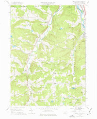
1968 Map of Franklin Forks
USGS Topo · Published 1976About this map
Snake Creek carves a central path through this landscape, connecting a series of rural hamlets including Stanfordville, Lawsville Center, and Franklin Forks. In the late 1960s, this portion of Susquehanna County maintained a character defined by dispersed agriculture and local industry, evidenced by the numerous Quarries and Gravel Pits dotting the hillsides near Stonecrop Hill and Franklin Hill.
Find a feature on this map
45 named features on this map. Tap any name to fly to it.
Don’t see what you’re looking for? This feature index may not catch every label — zoom into the map to look around manually.
Map Details
Editions of this 1968 Franklin Forks Map
Other maps of this area

1904 · Binghamton
USGS Topo · 1:62,500

1905 · Nineveh
USGS Topo · 1:62,500

1932 · Susquehanna
USGS Topo · 1:62,500

1935 · Binghamton West
USGS Topo · 1:24,000

1935 · Susquehanna
USGS Topo · 1:62,500

1937 · Binghamton East
USGS Topo · 1:24,000

1942 · Binghamton West
USGS Topo · 1:31,680

1942 · Binghamton East
USGS Topo · 1:31,680

1943 · Montrose
USGS Topo · 1:62,500

1945 · Montrose
USGS Topo · 1:62,500