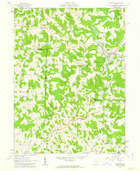
1961 Map of Freeport
USGS Topo · Published 1963About this map
Stillwater Creek carves a winding path through this corner of eastern Ohio, where the hills of Harrison and Guernsey counties meet. The landscape is defined by its early survey lines, including the historic boundary between the United States Old Military District and the Seven Ranges. These geometric land divisions cut across a terrain of deep hollows drained by Craborchard Creek and Skull Fork.
Find a feature on this map
32 named features on this map. Tap any name to fly to it.
Don’t see what you’re looking for? This feature index may not catch every label — zoom into the map to look around manually.
Map Details
Editions of this 1961 Freeport Map
3 editions found
Other maps of this area

1902 · Scio
USGS Topo · 1:62,500

1903 · Flushing
USGS Topo · 1:62,500

1904 · Scio
USGS Topo · 1:62,500

1905 · Flushing
USGS Topo · 1:62,500

1909 · Antrim
USGS Topo · 1:48,000

1909 · Uhrichsville
USGS Topo · 1:62,500

1911 · Antrim
USGS Topo · 1:62,500

1911 · Uhrichsville
USGS Topo · 1:62,500

1951 · Canton
USGS Topo · 1:250,000

1953 · Canton
USGS Topo · 1:250,000