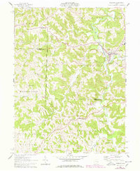
1961 Map of Freeport
USGS Topo · Published 1978About this map
Freeport sits at the junction of several key valleys in this corner of Harrison and Guernsey counties, where the Baltimore and Ohio railroad corridor follows the winding course of Stillwater Creek. This 1961 survey, updated with late-1970s revisions, illustrates the complex surveying history of the Ohio country, clearly marking the United States Old Boundary dividing the United States Military District from the Old Seven Ranges.
Find a feature on this map
31 named features on this map. Tap any name to fly to it.
Don’t see what you’re looking for? This feature index may not catch every label — zoom into the map to look around manually.
Map Details
Editions of this 1961 Freeport Map
3 editions found
Other maps of this area

1902 · Scio
USGS Topo · 1:62,500

1903 · Flushing
USGS Topo · 1:62,500

1904 · Scio
USGS Topo · 1:62,500

1905 · Flushing
USGS Topo · 1:62,500

1909 · Antrim
USGS Topo · 1:48,000

1909 · Uhrichsville
USGS Topo · 1:62,500

1911 · Antrim
USGS Topo · 1:62,500

1911 · Uhrichsville
USGS Topo · 1:62,500

1951 · Canton
USGS Topo · 1:250,000

1953 · Canton
USGS Topo · 1:250,000