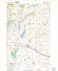
1965 Map of Freeport
USGS Topo · Published 1980About this map
The town of Freeport serves as a central hub in this Central Minnesota landscape, where the Great Northern railway and Stearns County Great Northern lines parallel the developing road network. This mid-1960s survey illustrates a region defined by its numerous glacial water bodies, from the expansive Kings Lake and Uhlenkolts Lake to the protected wetlands of the National Waterfowl Production Area. Local education and faith are anchored by rural landmarks like School No 1992 and Immaculate Conception Ch in New Munich. To the north, the small settlement of St Rosa sits amidst a scattering of smaller lakes and gravel pits. The presence of the Soo Line in the south and the winding path of Getchell Creek further highlight the intersection of mid-century infrastructure and the natural drainage patterns of Stearns County.
Find a feature on this map
36 named features on this map. Tap any name to fly to it.
Don’t see what you’re looking for? This feature index may not catch every label — zoom into the map to look around manually.
Map Details
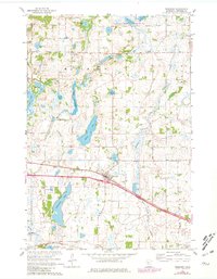
Editions of this 1965 Freeport Map
3 editions found
Other maps of this area

1950 · Swanville
USGS Topo · 1:62,500

1953 · Saint Cloud
USGS Topo · 1:250,000

1957 · Saint Cloud
USGS Topo · 1:250,000

1958 · Saint Cloud
USGS Topo · 1:250,000

1965 · Albany
USGS Topo · 1:24,000

1965 · Farming
USGS Topo · 1:24,000

1965 · Greenwald
USGS Topo · 1:24,000

1965 · Melrose
USGS Topo · 1:24,000

1965 · Freeport
USGS Topo · 1:24,000

1965 · St Martin
USGS Topo · 1:24,000