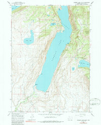
1964 Map of Fremont Lake South
USGS Topo · Published 1986About this map
Pinedale sits at the southwestern corner of this landscape, serving as a gateway to the dramatic glacial lakes and forest lands of the Bridger National Forest. The topography is dominated by the long, deep reach of Fremont Lake, flanked by the high ground of Fremont Ridge and the prominent Fortification Mountain. This survey illustrates the early development of recreational and agricultural infrastructure in the region, including the Winter Sports Area near Surveyor Park and various camps such as the Half Moon Lake Campground. The intricate water management system is visible through the Highland Ditch and Fremont Ditch, which redirect water from the high basins toward the valley floor. Pack routes like the Summit Lake Trail and Lowline Trail snake through the northern timberline, marking the traditional paths into the high backcountry long before modern road expansion.
Find a feature on this map
34 named features on this map. Tap any name to fly to it.
Don’t see what you’re looking for? This feature index may not catch every label — zoom into the map to look around manually.
Map Details
Editions of this 1964 Fremont Lake South Map
3 editions found

Other maps of this area

1909 · Fremont Peak
USGS Topo · 1:125,000

1955 · Thermopolis
USGS Topo · 1:250,000

1955 · Lander
USGS Topo · 1:250,000

1958 · Lander
USGS Topo · 1:250,000

1958 · Thermopolis
USGS Topo · 1:250,000

1961 · Lander
USGS Topo · 1:250,000

1962 · Thermopolis
USGS Topo · 1:250,000

1964 · Boulder Lake
USGS Topo · 1:24,000

1964 · Mount Airy
USGS Topo · 1:24,000
1964 · Cora
USGS Topo · 1:24,000