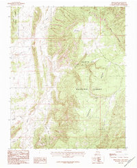
1983 Map of French Mesa
USGS Topo · Published 1983About this map
Santa Fe National Forest encompasses the dramatic uplift of French Mesa in this northern New Mexico landscape as recorded in the early 1980s. The topography is defined by sharp elevation changes between the mesa top and the drainage networks of Rio Gallina and Arroyo Blanco. The importance of water in this arid environment is signaled by the inclusion of vital water sources such as Leandro Spring and Ojo la Jara, alongside the seasonal Dry Lake.
Find a feature on this map
14 named features on this map. Tap any name to fly to it.
Don’t see what you’re looking for? This feature index may not catch every label — zoom into the map to look around manually.
Map Details
Editions of this 1983 French Mesa Map
This is the sole edition of this map. No revisions or reprints were ever made.
Other maps of this area

1909 · Gallina
USGS Topo · 1:125,000

1940 · Cuba
USGS Topo · 1:62,500

1943 · Cuba
USGS Topo · 1:62,500

1953 · Arroyo Del Agua
USGS Topo · 1:24,000

1953 · Laguna Peak
USGS Topo · 1:24,000

1953 · Navajo Peak
USGS Topo · 1:24,000
1953 · Youngsville
USGS Topo · 1:62,500

1954 · Aztec
USGS Topo · 1:250,000

1955 · Llaves
USGS Topo · 1:62,500

1958 · Aztec
USGS Topo · 1:250,000