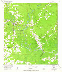
1953 Map of French Settlement
USGS Topo · Published 1962About this map
The Amite River defines the landscape of this riverine stretch of the Louisiana interior, winding its way through the borderlands of Livingston and Ascension Parishes. In the early 1950s, the primary settlements of Port Vincent and French Settlement were established at critical bends in the river, connected by a network of roads that follow the high ground and levee systems. This era of the landscape is marked by its numerous rural congregations and burial grounds, including the Lady of the Lake Ch, Our Lady Chapel, and the Watson Cem near the river’s edge. The geography is dominated by a complex system of waterways such as Colyell Creek and Cocodrie Bayou, which feed into larger bodies like Flat Lake and Littles Lake. This survey illustrates the intricate balance between human habitation and the swampy lowlands of the river basin, where landings like Tates Landing once served as vital points of access to the water.
Find a feature on this map
56 named features on this map. Tap any name to fly to it.
Don’t see what you’re looking for? This feature index may not catch every label — zoom into the map to look around manually.
Map Details
Editions of this 1953 French Settlement Map
2 editions found
Other maps of this area

1892 · Mount Airy
USGS Topo · 1:62,500

1892 · Donaldsonville
USGS Topo · 1:62,500

1934 · Denham Springs
USGS Topo · 1:62,500

1934 · Springfield
USGS Topo · 1:62,500

1935 · Gonzales
USGS Topo · 1:31,680

1939 · Springfield
USGS Topo · 1:62,500

1939 · Denham Springs
USGS Topo · 1:62,500

1939 · Donaldsonville
USGS Topo · 1:62,500

1946 · Petite Amite River
USGS Topo · 1:31,680

1947 · Sorrento
USGS Topo · 1:31,680