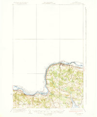
1935 Map of Frenchville
USGS Topo · Published 1935About this map
The St John River forms a wide, meandering international boundary in this 1930s survey, separating the rural highlands of Aroostook County from the neighboring woods of Canada. The Bangor and Aroostook RR traces the riverbank closely, serving as the industrial backbone for riverside settlements like Madawaska and Frenchville. This rail corridor is marked by several logistical points, including Pelletier Siding and Cleveland Siding, which likely facilitated the movement of local timber or agricultural products.
Find a feature on this map
41 named features on this map. Tap any name to fly to it.
Don’t see what you’re looking for? This feature index may not catch every label — zoom into the map to look around manually.
Map Details
Editions of this 1935 Frenchville Map
4 editions found
Other maps of this area

1927 · Stockholm
USGS Topo · 1:48,000

1927 · Square Lake
USGS Topo · 1:48,000

1928 · Eagle Lake
USGS Topo · 1:48,000

1931 · Square Lake
USGS Topo · 1:62,500

1931 · Eagle Lake
USGS Topo · 1:62,500

1931 · Stockholm
USGS Topo · 1:62,500

1932 · Frenchville
USGS Topo · 1:48,000

1932 · Fort Kent
USGS Topo · 1:48,000

1935 · Fort Kent
USGS Topo · 1:62,500

1935 · Frenchville
USGS Topo · 1:62,500