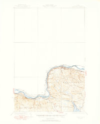
1935 Map of Frenchville
USGS Topo · Published 1951About this map
The St John River carves the northern boundary of this survey, defining the border between the United States and Canada in northernmost Maine. Along the riverbank, the Bangor and Aroostook railroad connects a series of small industrial and agricultural points, including St Luce Sta, Pelletier Siding, and Cleveland Siding. This transport corridor supported the settlement at Madawaska and the linear development of Frenchville.
Find a feature on this map
39 named features on this map. Tap any name to fly to it.
Don’t see what you’re looking for? This feature index may not catch every label — zoom into the map to look around manually.
Map Details
Editions of this 1935 Frenchville Map
4 editions found
Other maps of this area

1927 · Stockholm
USGS Topo · 1:48,000

1927 · Square Lake
USGS Topo · 1:48,000

1928 · Eagle Lake
USGS Topo · 1:48,000

1931 · Square Lake
USGS Topo · 1:62,500

1931 · Eagle Lake
USGS Topo · 1:62,500

1931 · Stockholm
USGS Topo · 1:62,500

1932 · Frenchville
USGS Topo · 1:48,000

1932 · Fort Kent
USGS Topo · 1:48,000

1935 · Fort Kent
USGS Topo · 1:62,500

1935 · Frenchville
USGS Topo · 1:62,500